Satellites monitor ocean currents
Is the ocean changing? New satellite measurement methods provide the answer.
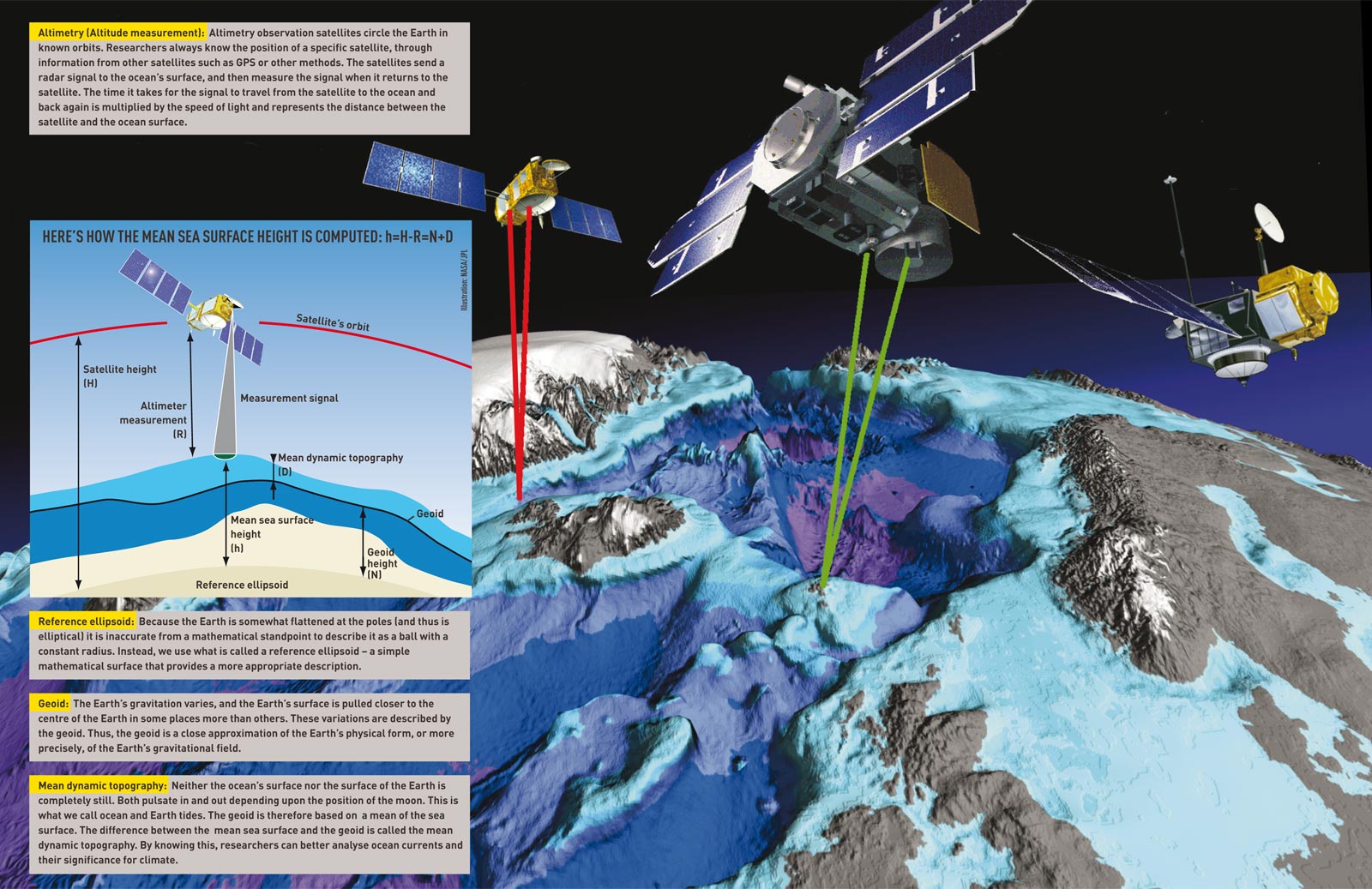
Global warming is likely to affect the polar climate early and significantly. Weakening of the ocean circulation would also significantly affect the climate in northern Europe. Harnessing the ability of Earth observation satellites, called satellite altimetry, is one way to detect these changes. Pioneered in part by the Geomatics group at NTNU, the method makes altitude measurements of the hills and valleys of the ocean’s surface.
Sea ice makes measurement difficult, as does measuring the ocean surface itself, because there are many sources of errors.
For example, the pull of the moon’s gravity results in movements in the ocean itself – the tides. Nevertheless, geomatics engineers have been able to develop a computational technique that can determine the mean sea surface height with an accuracy of a few centimetres. The model can be used to keep track of all the world’s oceans with a repeat cycle of several days.
The measurement models were developed as a part of the Research Council of Norway’s OCTAS project. OCTAS (Ocean Circulation and Transport between North Atlantic and the Arctic Ocean) studied ocean currents and advanced the understanding of the role of the ocean mass and heat transport in climate change.
The project was focused on the area between the North Atlantic and the Arctic Ocean, with special attention to the Fram Strait between Svalbard and Greenland. Among the partners in the project were NTNU, the Norwegian Mapping Authority; the Nansen Environmental and Remote Sensing Centre; the universities in Oslo, Bergen and Ås, as well as Danish and American research groups.
OCTAS was started in 2003 and formally ended in 2007. But much of the work is still ongoing.
Text: Synnøve Ressem
Graphics: Shum&Braun2004
Source: Professor Hossein Nahavandchi, Department of Civil and Transport Engineering, NTNU